
9 Notorious London Slums & What They Look Like Today
Notting Hill was once one of the most notorious London slums. But today, as you stroll through the land of pastel houses and movie stars, you’d never know it.
So many areas of London are like this; in just a few hundred years they went from pest houses to posh houses.
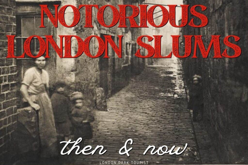
Let’s look at some of the most notorious Victorian slum housing in London and see what it looks like today.
Mapping Victorian Slums: Charles Booth’s Poverty Maps

Victorian London was full of an odd mix of very poor and very rich. One block could be downright dangerous, and the next block fit for the King.
Nowhere is this more apparent than on Charles Booth’s iconic Poverty Maps.
Published in 1889-1890, Booth and his cohorts meticulously surveyed every street in London. They are now fully digitized, so it’s easy to see exactly what your street used to be like more than a century ago.
It’s important to note that by 1890, some of the worst slums of the past had already been cleared.
But London slums evolved and changed over time, moving away from one neighborhood and popping up in another.
Here are some of London’s worst neighborhoods of 1890 that are rather posh today, all mapped by Charles Booth in his iconic maps.
1. Battersea: Victorian Slum Housing on the Thames

Today this riverfront area fetches handsome property prices. But in Victorian London, Battersea was merely working class due to the amount of factories and docks in the area.
Booth noted: “Some of the courts have long been notorious… (e.g. Europa Place or “Little Hell”) ….The isolated block at Nine Elms [is] the worst spot in the district.”

Today, the Nine Elms neighborhood (near the former home of Belfour street) features the newly-renovated Battersea Power Station: a giant shopping centre in the converted station with luxury apartments above.
A small studio in the complex fetches close to £700,000, while a massive six bedroom in the complex fetches a cool £6 million.
You can buy a more modest terraced home on Europa Place (now Battersea Church Road, or thereabouts) for £1.3 million.
Long gone are the factories and laborers, and in their place are Jo Malone and Laudreé macarons.
2. Kensington & Chelsea: Victorian Slums of Market Court
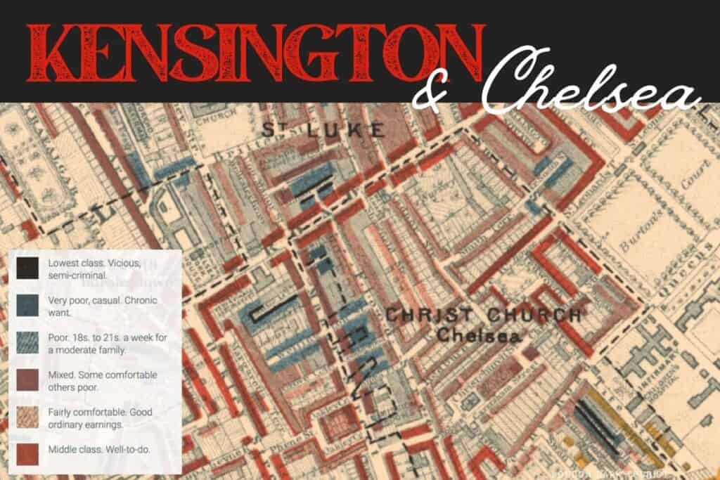
It’s hard to believe that parts of William & Kate’s local lair were once undesirable. But just off Kensington High Street was Market Court, a “hidden slum” full of the most unimaginable poverty.
Turks Row, off Lower Sloane Street, along with Draycott Avenue, Cale Street, and Thames-adjacent World’s End were notoriously poor and fetid.

Today, no one but the super, uber, unimaginably rich can live in the Borough of Kensington and Chelsea.
All of London’s most expensive streets are in this area, if you include neighboring Notting Hill and Belgravia. Would I want to live there?
No, it’s posh to the point of bland. But it’s a fun place to browse the charity shops.
3. Rookeries of London: Holborn’s Great Wild Street

Holborn, long associated with Charles Dickens, lawyers and barristers, and now the London School of Economics, has always been a fairly well-to-do neighborhood.
Dickens, for example, places his lawyer’s offices in these streets, and not his scrappy streetwise characters.
But there were some, including Great Wild Street (pictured on the map above), that were positively putrid.
Booth wrote that Great Wild Street was “Worse than Nottingham Court [a Covent Garden slum]. Many flower girls [poor women selling crocheted flowers], drunk, Irish, fighting…the buildings do not look so bad outside but inside the smell is awful.”

Today you may visit Holborn to see the British Museum, or stroll through beautiful Bloomsbury, or wander down to Covent Garden to catch a show. But you can’t live here unless you’ve millions of pounds to spare.
Check out my London Dark History map to see all the most notable spots in Holborn and beyond.
4. Bermondsey: Jacob’s Island

This area of Bermondsey, south and a bit east of Tower Bridge on the Thames, was once called “Jacob’s Island,” and one of the worst slums in London.
Situated at the confluence of the Thames, the River Neckinger, and a bunch of tidal ditches, it was basically a floating swamp of cholera.
Jacob’s Island was immortalized in Charles Dickens’ Oliver Twist, where villian Bill Sikes dies in the mud of Folly Ditch.
Henry Mayhew, a writer who documented London life of the era, wrote of this place:
“The air has literally the smell of a graveyard…The water is covered with a scum almost like a cobweb…In it float large masses of green rotting weed, and against the posts of the bridges are swollen carcasses of dead animals, almost bursting with the gases of putrefaction.”
-Henry Mayhew
Those who lived there were constantly sick, and appeared so.
“Scarcely a girl that has not suffusion and soreness of the eyes, so that you would almost fancy she had been swallowing small doses of arsenic” wrote Mayhew.

The area was heavily bombed in the Blitz, and afterwards was redeveloped with high rise apartment buildings and luxury lofts.
These days it’s hard to find a flat for under £1 million, and those with river views easily fetch over £3 million.
It’s a great neighborhood to wander, with excellent markets, coffee shops, and restaurants, without–thankfully–a trace of the horrid conditions that this area was known for in the past.
5. Shoreditch: Old Nichol Slum

Charles Booth published his poverty maps only a decade after the notorious Jack the Ripper murders, and the area hadn’t improved much in those ten years.
The Old Nichol slum in the East End, in what is now trendy Shoreditch near Bethnal Green, was a vast and horrid rookery.
“An almost total lack of drainage and sewerage was made worse by the ponds formed by the excavation of brickearth. Pigs and cows in back yards, noxious trades like boiling tripe, melting tallow, or preparing cat’s meat, and slaughter houses, dustheaps, and ‘lakes of putrefying night soil’ added to the filth.”
–Henry Mayhew
In 1844, Old Nichol’s held 1,400 homes in an area of only 400 square yards, with an average of over 8 people per dwelling.
Thieves and sex workers were rampant, and sanitation was non-existent, with no sewers and running water available for only 10-12 minutes per day.
A few years before Booth published his maps, it was noted that the death rate was four times that of the rest of London, and calls for change were finally heard after the 1890 Housing of the Working Classes Act.

Today, Shoreditch is a hip and trendy place to live and work. Lots of tech companies have taken residence here, as well as in nearby Old Street, and properties fetch a pretty penny.
It’s a great area to wander, check out the street art, grab a bagel on Brick Lane, and visit all of Jack the Ripper’s murder locations.
Thankfully today you won’t run into anyone boiling tripe or shoveling “night soil” (human excrement).
6. Westminster: The “Devil’s Acre”

By the time Booth surveyed this area of Westminster called “The Devil’s Acre,” it had been somewhat improved from what Dickens called “the most deplorable manifestation of human wretchedness and depravity.”
This area–just 6 streets away from Westminster Abbey–was built on marshland, so it was never going to be desirable real estate for London’s social climbers.
What it turned into in the 1800s, however, was the worst of Victorian slum housing.
The land was owned by the monks of the Abbey, where they offered “sanctuary” to those in need, and it became known as “The Sanctuary”; the street still bears the name today.
Legend has it (though I can’t find evidence to corroborate this) that criminals were safe from the law since they were on Abbey land.
It quickly turned into a den of iniquity, housing the poorest and most criminal in London.
There was no sanitation, an average of twelve people crammed into rooms with no lighting or water, and outbreaks of cholera and typhus were worsened by infestations of rats and fleas. It was the first location to ever be coined a “slum.”

In the 1850s, the authorities planned to run a road (now Victoria Street) through the slum, but all this did was disperse it a bit.
They then built affordable housing, still in use today, which ran off the poorest of the residents, but some nearby streets still suffered horrible conditions, as pictured in Booth’s 1890 map above.
There was, tragically, nowhere for them to go. If they couldn’t even afford the discounted rents, they had to move on to other slums.
Today, Westminster is downright posh. We often don’t often think of it as a residential neighborhood, but it houses many wealthy Londoners in flats ranging from very tiny (over £1 million) to palatial (over £4 million), not to mention those-who-shall-not-be-named living at 10 Downing Street.
You’ll be overrun with tourists most times of year, and you will have to put up with £8 flat whites and Home Office suits, but if you can afford it, why not?
7. Notting Hill’s Potteries & Piggeries

Hard to believe that this idyllic little enclave northwest of Kensington used to be treacherous, right? But it was, and it didn’t get any worse than Pottery Lane, home to the infamous “Potteries and Piggeries” of Notting Hill.
This slum was so wretched and notorious that it brought down a nearby racetrack venture just by association.
The “pottery” portion of the name came from the clay soil native to the area, on top of which were built kilns for brickmaking, and therefore attracted cheap laborers to live and work nearby.
The “piggeries” came from residents’ keeping of pigs in their yards. Naturally, this area quickly deteriorated. As the clay was extracted, water runoff filled the empty holes with sewage and animal carcasses, mixing with the clay to form a sort of Chernobyl of muddy puddles.
One of these putrid holes became so large that it was coined “the ocean.”

In 1837, an entrepreneur called John Whyte wanted to build a racecourse to rival Epsom within London. He purchased a large tract of land to build the Hippodrome, but it bordered on the potteries and piggeries.
His venture failed within 5 years simply because of its proximity to the slum and its association with those who lived there. Racecourse attendants constantly had to kick out the locals because they brought down the vibe.
They just wanted to watch the races!

Today, Notting Hill is one of the poshest addresses you can ever hope to attain. On Pottery Lane, home to super-Instagrammable pastel-painted homes like a lot of Notting Hill, terraced houses fetch around £2.5-3 million.
The only trace of its rough past remaining is one lone brick kiln, located on Walmer Road.
If you’re there, check out the pub The Champion to see where notorious serial killers lured their prey.
8. Covent Garden’s Seven Dials Slum

The notorious Seven Dials Slum in Covent Garden was already gone by the time Booth surveyed the area for his maps. But this was one tough slum to get rid of.
The St Giles Rookery was the most infamous in all of London, and the name itself became a “synonym of filth and squalor.”
The dark and twisting streets were full of poverty, human waste, gin shops and trash. There was no running water, no sewer, and no trash service.
Seven Dials is so named for seven streets that converge here, and in the Victorian period, each corner held a raucous pub that only fueled the drunken brawls.
John Keats described the area as “where misery clings to misery for a little warmth.”

Today you can wander Seven Dials before you hit the West End theatres. It’s now a posh shopping district with great restaurants (my favorite spot is the Seven Dials Food Hall).
There’s no trace of the rookery that once sprawled out from Seven Dials, but wandering the cobblestone alleyways, you can imagine what the area once was.
9. Canary Wharf: Poverty in the Docklands

The Canary Wharf area was once home to slums next to London’s docklands. Ships from all over the world carrying both cargo and immigrants landed here, and the poorest passengers simply had nowhere to go.
They often landed in the slum at St George, which was a collection of derelict houses and hovels that was home to the poorest East End residents.
Day laborers also lived nearby, in the hopes of landing a few paid hours unloading cargo at the docks.

As it was a massive international trade center and manufacturing hub, the docklands were heavily bombed in WWII. When it was time to rebuild, the entire area was reimagined as Canary Wharf.
It’s now home to luxury high rises that only the wealthiest Londoners can afford. Even a converted loft in an old factory will set you back millions of pounds.
It’s also a financial and business hub, with many large corporations calling it home. It’s a far cry from the poor industrial area it once was.
London Slums Today
Wandering these now-posh areas, you’d never know that horrible history behind them. But under every brick and cobblestone in London’s historic streets are centuries of stories.
More on London’s Dark History
Gross Jobs in the 1800s: 10 Dirty and Dangerous Victorian Jobs
What’s the Oldest Pub in London? 13 Curious Contenders
Kray Walking Tour of East London: 7 Free Spots You Can See Today
London Serial Killers: 11 Documentaries on YouTube to Watch Now
10 Ghastly Royal Deaths and What Happened to Their Corpses
London Charterhouse Square: Are There 50,000 Bodies Buried in this Lovely Garden?
Temple Bar London: Why did this London City Gate Sport Rotting Heads on Top?


